b40.20th.track1.1deg.006_yrs81-05
and
b40.20th.track1.1deg.006
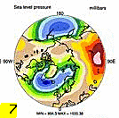
DIAG Set 7 - Polar contour plots of DJF, JJA and ANN means
Surface Variables
Northern Hemisphere
DJF
JJA
ANN
ALBSURF
Albedo at surface
plot
plot
plot
PS
Surface pressure
plot
plot
plot
PSL
Sea level pressure
plot
plot
plot
SURF WIND
Near surface wind
plot
plot
plot
TS
Surface temperature
plot
plot
plot
Southern Hemisphere
ALBSURF
Albedo at surface
plot
plot
plot
PS
Surface pressure
plot
plot
plot
PSL
Sea level pressure
plot
plot
plot
SURF WIND
Near surface wind
plot
plot
plot
TS
Surface temperature
plot
plot
plot
Constant Pressure Levels
Northern Hemisphere
DJF
JJA
ANN
Z 500
500 mb geopotential height
plot
plot
plot
Southern Hemisphere
Z 500
500 mb geopotential height
plot
plot
plot
Hydrologic Cycle
Northern Hemisphere
DJF
JJA
ANN
PRECT
Precipitation rate
plot
plot
plot
PRECST
Snowfall rate
plot
plot
plot
ICEFRAC
Sea-ice concentration
plot
plot
plot
SNOWH
Snow depth water equivalent
plot
plot
plot
SNOWHICE
Snow depth water equivalent
plot
plot
plot
SNOWHLND
Snow depth water equivalent
plot
plot
plot
Southern Hemisphere
PRECT
Precipitation rate
plot
plot
plot
PRECST
Snowfall rate
plot
plot
plot
ICEFRAC
Sea-ice concentration
plot
plot
plot
SNOWH
Snow depth water equivalent
plot
plot
plot
SNOWHICE
Snow depth water equivalent
plot
plot
plot
SNOWHLND
Snow depth water equivalent
plot
plot
plot
Surface Energy Fluxes
Northern Hemisphere
DJF
JJA
ANN
FLDS
Longwave downwelling flux
plot
plot
plot
FLDSC
Clearsky LW downwelling flux
plot
plot
plot
FLNS
Net longwave flux
plot
plot
plot
FLNSC
Clearsky Net longwave flux
plot
plot
plot
FSDS
Shortwave downwelling flux
plot
plot
plot
FSDSC
Clearsky SW downwelling flux
plot
plot
plot
FSNS
Net shortwave flux
plot
plot
plot
FSNSC
Clearsky net shortwave flux
plot
plot
plot
Southern Hemisphere
FLDS
Longwave downwelling flux
plot
plot
plot
FLDSC
Clearsky LW downwelling flux
plot
plot
plot
FLNS
Net longwave flux
plot
plot
plot
FLNSC
Clearsky Net longwave flux
plot
plot
plot
FSDS
Shortwave downwelling flux
plot
plot
plot
FSDSC
Clearsky SW downwelling flux
plot
plot
plot
FSNS
Net shortwave flux
plot
plot
plot
FSNSC
Clearsky net shortwave flux
plot
plot
plot
Top of Model Energy Fluxes
Northern Hemisphere
DJF
JJA
ANN
ALBEDO
TOA albedo
plot
plot
plot
ALBEDOC
TOA clearsky albedo
plot
plot
plot
FLNT
Net longwave flux
plot
plot
plot
FSNT
Net shortwave flux
plot
plot
plot
Southern Hemisphere
ALBEDO
TOA albedo
plot
plot
plot
ALBEDOC
TOA clearsky albedo
plot
plot
plot
FLNT
Net longwave flux
plot
plot
plot
FSNT
Net shortwave flux
plot
plot
plot
Cloud Variables
Northern Hemisphere
DJF
JJA
ANN
CLDHGH
High-level cloud cover
plot
plot
plot
CLDLOW
Low-level cloud cover
plot
plot
plot
CLDMED
Mid-level cloud cover
plot
plot
plot
CLDTOT
Total cloud cover
plot
plot
plot
TGCLDIWP
Total grid-box cloud liquid water path (ice)
plot
plot
plot
TGCLDLWP
Total grid-box cloud liquid water path (liquid)
plot
plot
plot
Southern Hemisphere
CLDHGH
High-level cloud cover
plot
plot
plot
CLDLOW
Low-level cloud cover
plot
plot
plot
CLDMED
Mid-level cloud cover
plot
plot
plot
CLDTOT
Total cloud cover
plot
plot
plot
TGCLDIWP
Total grid-box cloud liquid water path (ice)
plot
plot
plot
TGCLDLWP
Total grid-box cloud liquid water path (liquid)
plot
plot
plot