
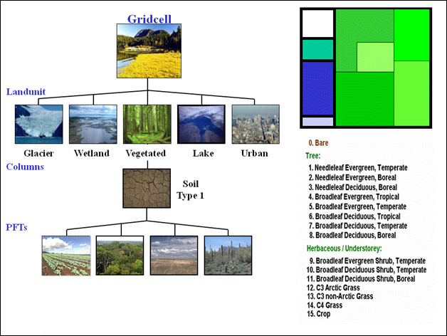
CLM: Surface Heterogeneity
The land surface is represented by 5 primary sub-grid land cover types (landunits: glacier, lake, wetland, urban, vegetated) in each grid cell. The vegetated portion of a grid cell is further divided into patches of plant functional types, each with its own leaf and stem area index and canopy height. Each subgrid land cover type and PFT patch is a separate column for energy and water calculations.
CESM Project
The Community Earth System Model (CESM) is a fully-coupled, global climate model that provides state-of-the-art computer simulations of the Earth's past, present, and future climate states.
CESM is sponsored by the National Science Foundation (NSF) and the U.S. Department of Energy (DOE). Administration of the CESM is maintained by the Climate and Global Dynamics Laboratory (CGD) at the National Center for Atmospheric Research (NCAR).
CLM Overview
CLM Model Description
- Surface Heterogeneity
- Biogeophysics
- Hydrologic Cycle
- Biogeochemistry
- Human Dimensions
- Ecosystem Dynamics